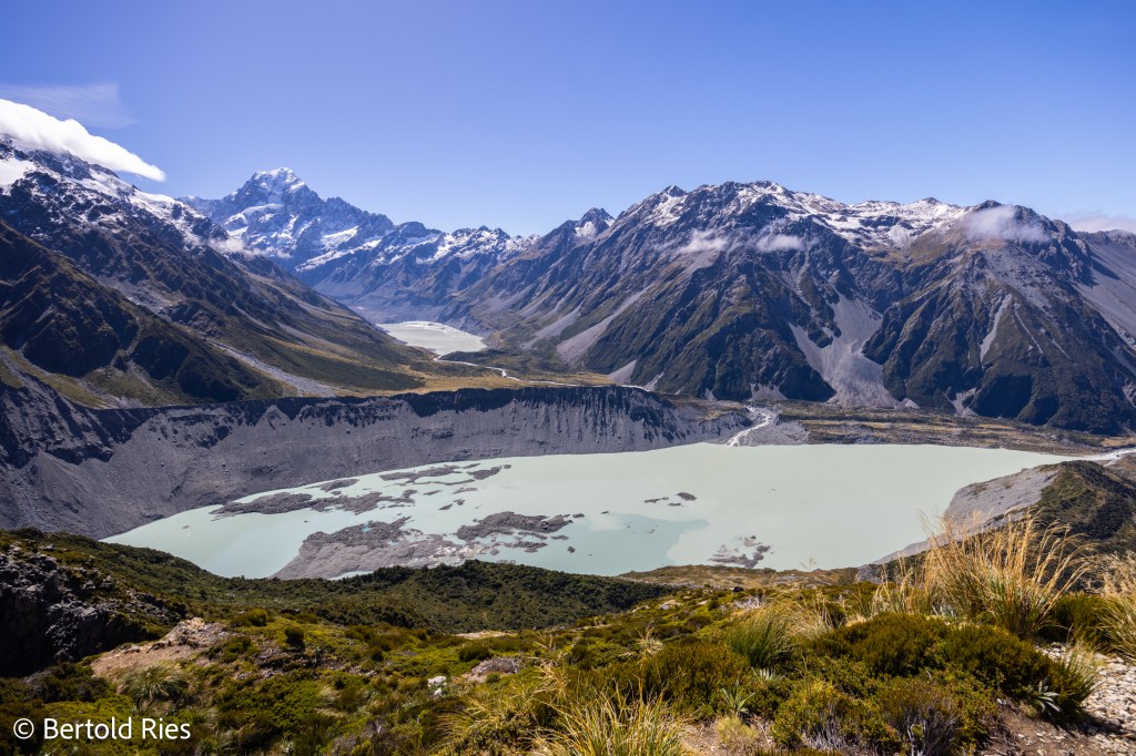
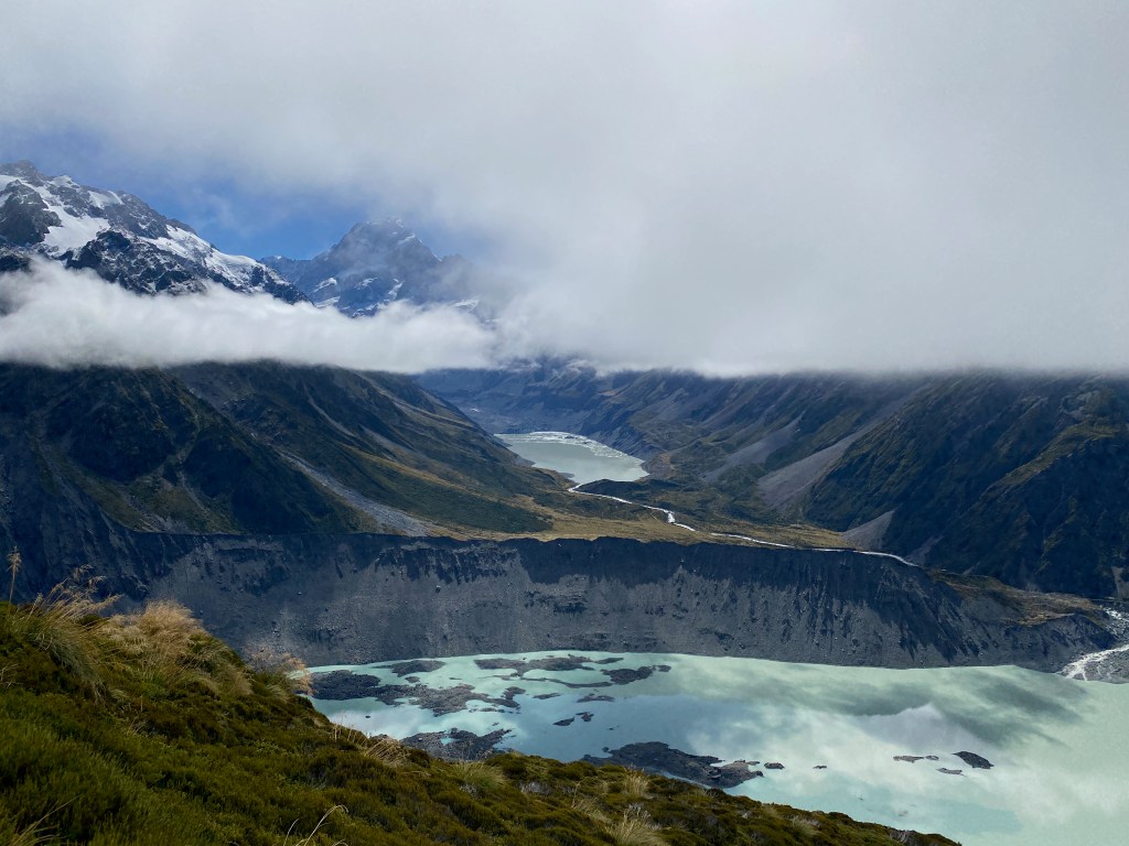
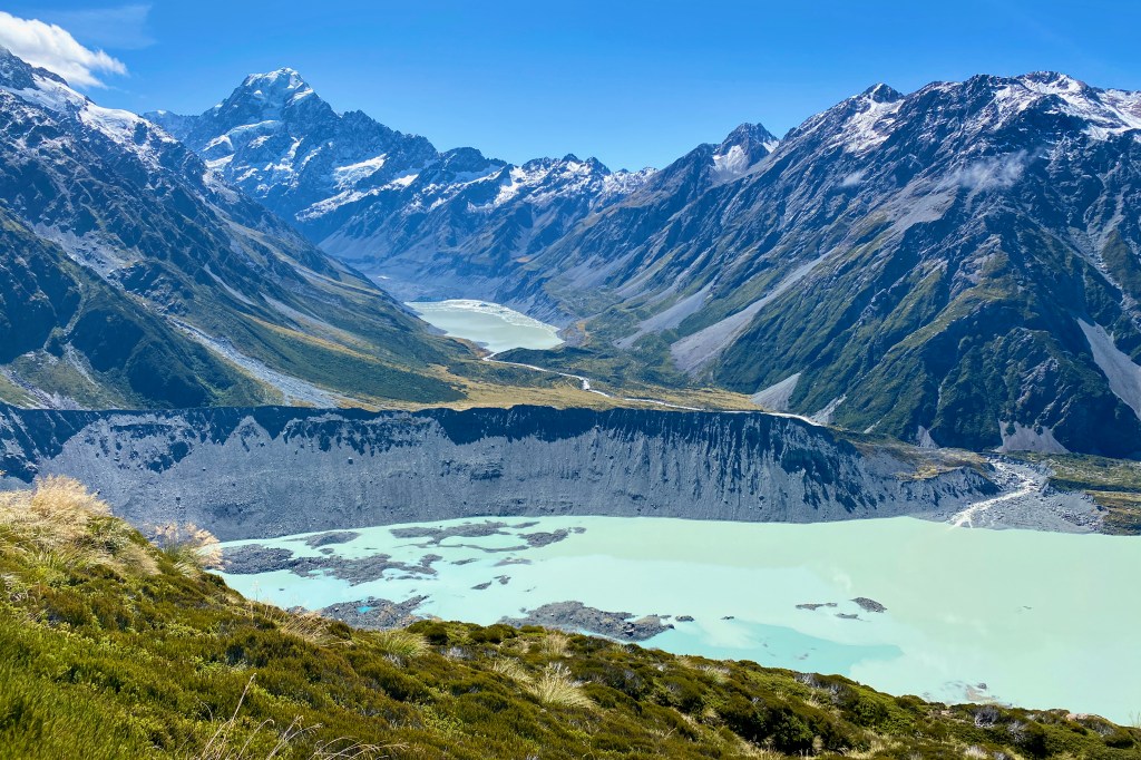
Not sure if people picture a pretty decent mountain range when they think about New Zealand. The “Southern Alps” extend roughly 500 km on the south island from northeast to southwest. The highest mountain is called “Aoraki / Mount Cook” (3’724 m) – in the picture above shown on the left. In the back the Hooker Glacier Lake and in the front the lateral-moraine of the Mueller Glacier with its proglacial lake. This spectacular photo has been taken from the Sealy Tarns Lookout. It’s a tough ascent though…
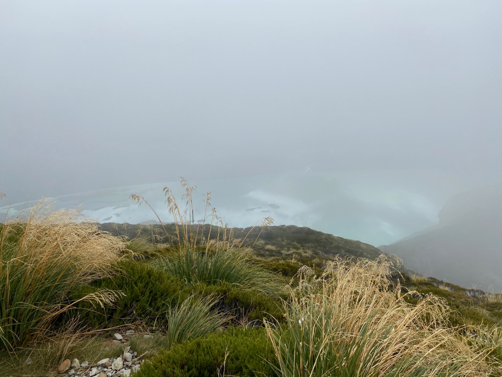
About 2’200 steps have been built into the Sealy mountain starting at 760 m.a.s.l. and reaching the lookout at 1’310 m.a.s.l. The day started foggy and cloudy. Still I decided to hike up (gut feeling …). When I reached the lookout at 11:20 am the view was as in the picture below. And now flip through the gallery and see what happened over the next one and a half hours:


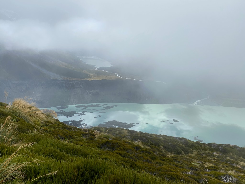
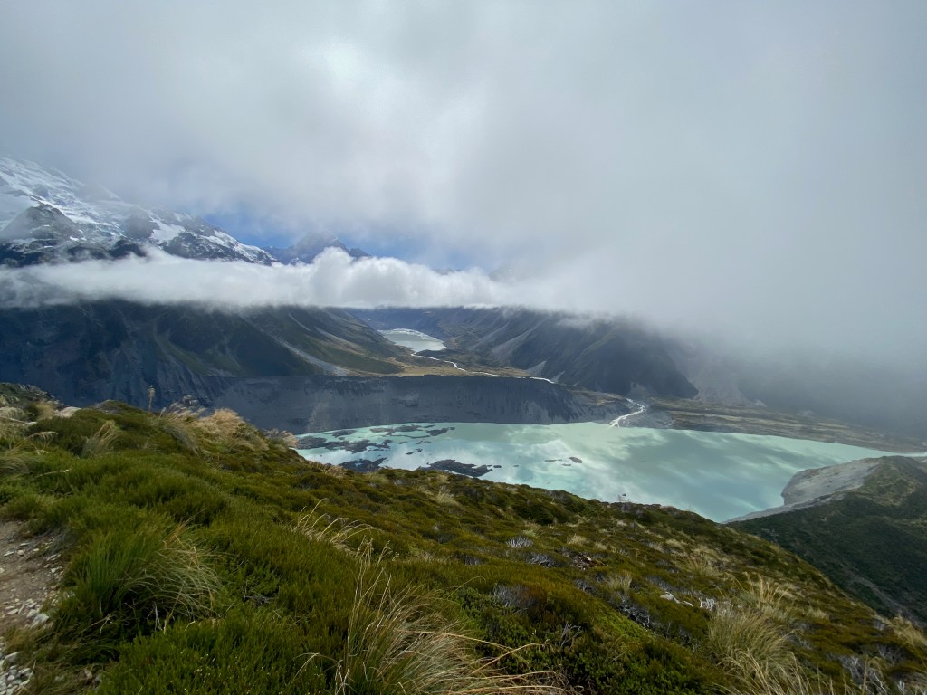

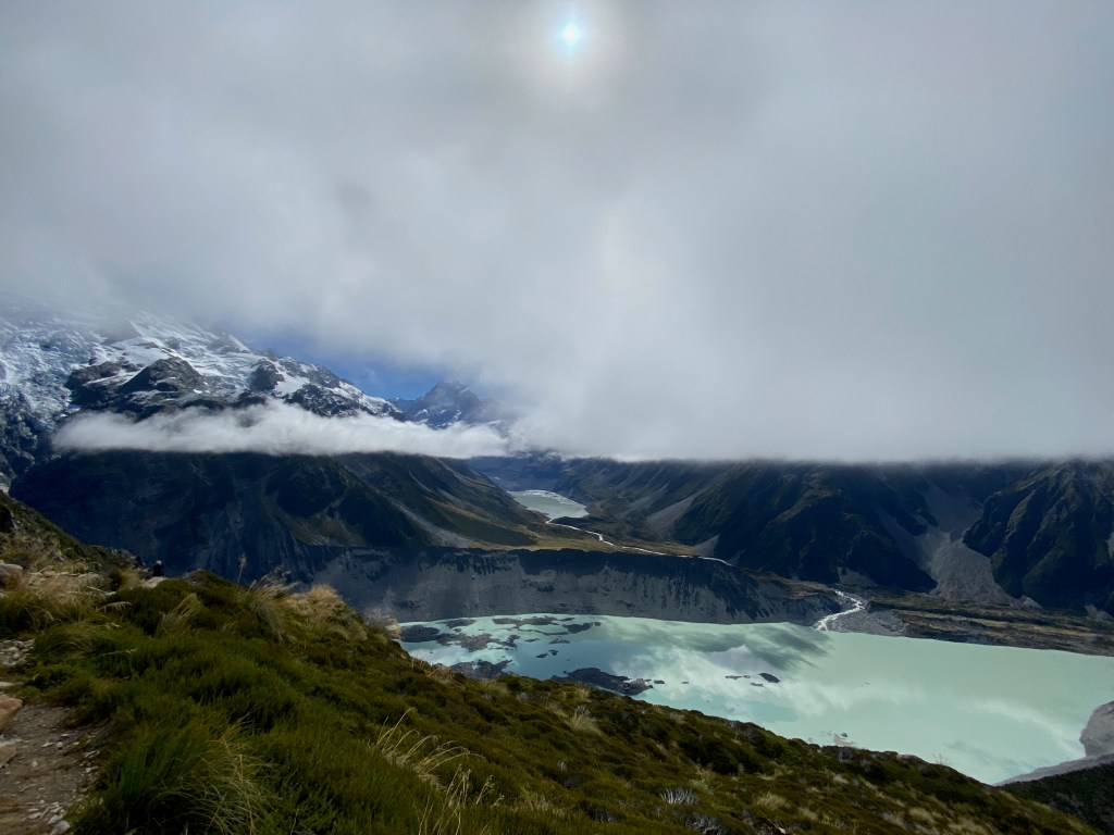
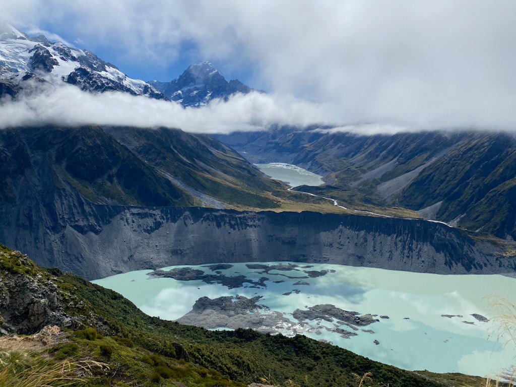
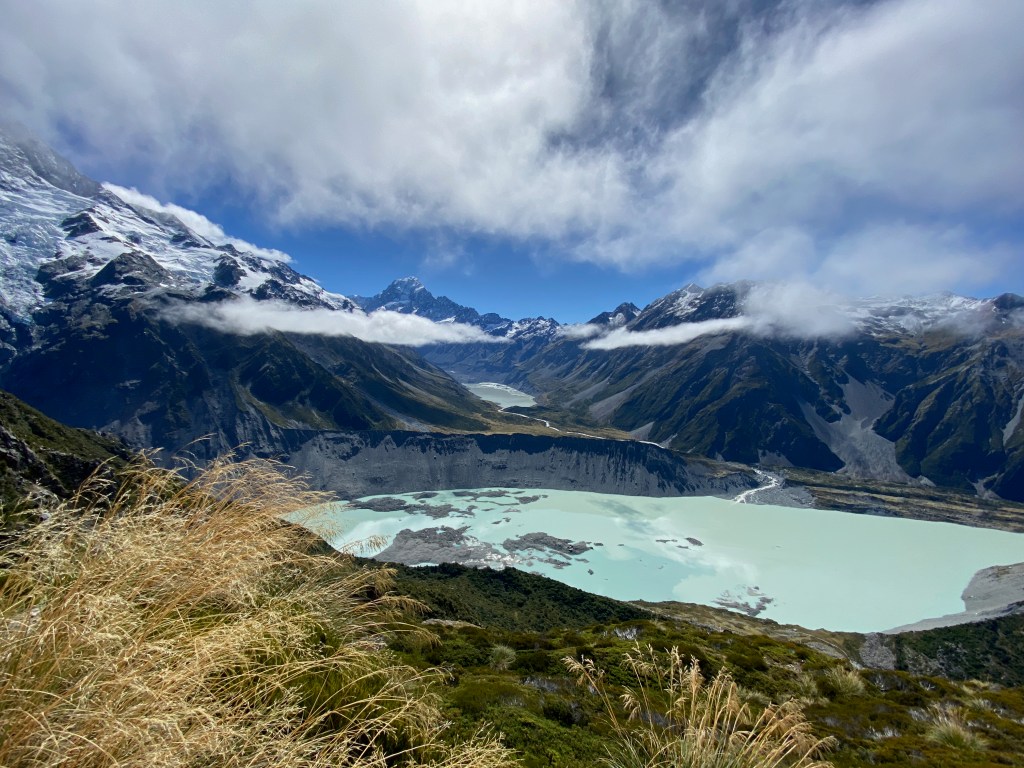
This was better than any movie! Some folks reached the top at the same time as I did but left frustrated as they did not have the patience to let nature do the job …
But let me give you the full 180 degree view as the valley opens up towards the southeast. One can see the bed of the Hooker river which unites further down with the Tasman river to feed Lake Pukaki which cannot be seen from the lookout.

Okay, now 2’200 steps down and right on the Hooker Valley Track to reach the Hooker Glacer Lake – the one in the back of the above photo. On the way I could take a look into the lateral-moraine of the Mueller Glacier:
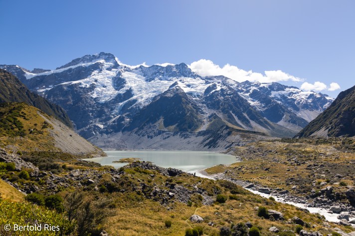
After rouphly 5 km easy walking I reached the Hooker Glacier Lake and was rewarded with a spectacular view of Aoraki / Mount cook. I red somewhere that the probability to see the mountain is 33% on average. The probability of having a clear view without a single cloud was not reported. So I must have been really lucky!!
Behind this mountain range is the Tasman Glacier and lake. Energized from the fantastic nature I hiked the 5 km back jumped into the car, drove 15 min. to the Tasman Glacier Car Park and there another rouphly 300 steps were waiting for me. I have to admit they became quite hard to take having been hiking around for 8 hours that day already. Anyway …

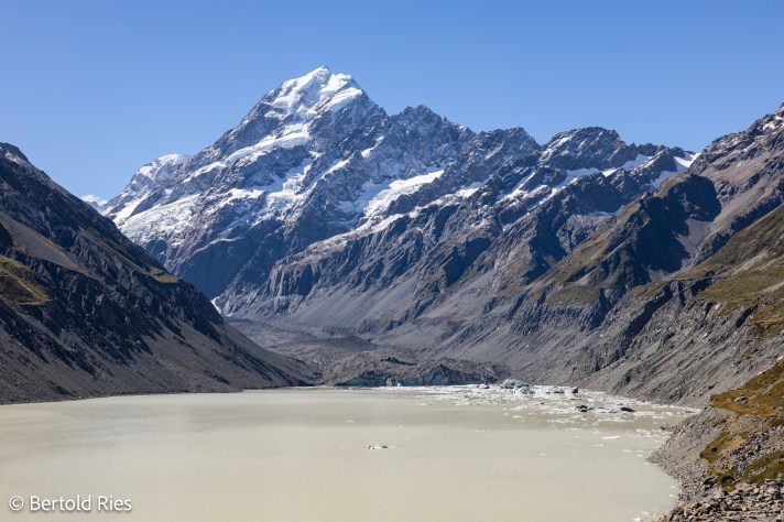
The next day I had to leave and as you can see from the picture below the weather worsend a bit. Still I could captrue the majestic Aoraki / Mount Cook once more.
The road that connects from the east side of the Southern Alps with the west side is the Haast Pass road and certainly one that should not be missed anyway. In the Mount Aspring National Park many beautiful views invite for a stop.
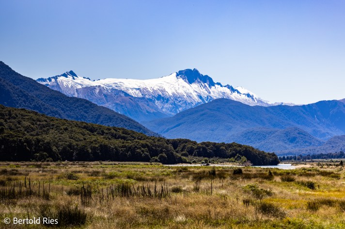
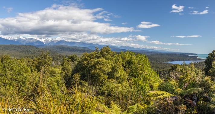
On the west side the Southern Alps and the sea are very close. From Okarito there is a 2 km walk to reach a great lookout – 160 m.a.s.l – high enough to look over the rain forrest towards the Alps!
One of the highlisghts here is the Franz Josef Glacier.

Stay tuned for my next post in which I will feature this fascinating and unique spot on earth.
